 Background |
Models |
Projects |
Publications |
People |
News
Background |
Models |
Projects |
Publications |
People |
News
Background |
Models |
Projects |
Publications |
People |
News
Scope of Projects
Everglades subregional: WCA2A Flow Restoration
Everglades regional: Sulfer & MeHg
Everglades subregional: WCA2A Wading Bird Suitability
Florida Coastal Everglades LTER
Everglades regional: SERES project
Spain Segura Basin: Ecological Economics
Everglades regional: CERP ASR
Everglades regional: CERP Decomp
Everglades WCA-1: unique restoration
Louisiana Davis Pond: restoration prototype
Everglades regional: cal/val (ELM v. 2.8)
Everglades regional: cal/val (ELM v. 2.5)
 We are collaborating on multi-decadal research and modeling in the southern Florida Coastal Everglades
as part of the FCE LTER program.
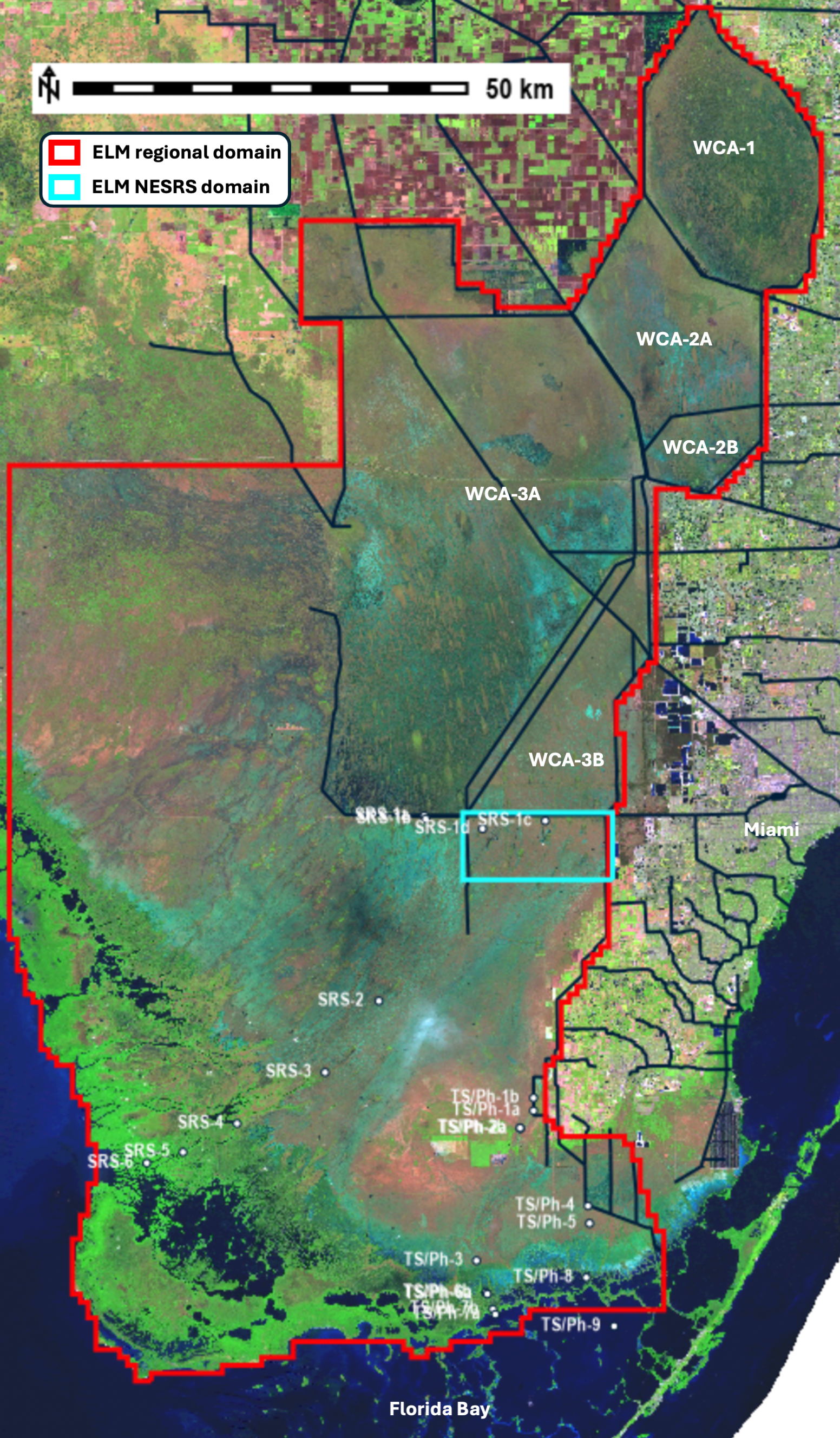
The 500 m resolution regional domain (below figure) of the Everglades Landscape Model (ELM) serves as a framework
in a truly integrated modeling approach towards understanding hydro-ecological gradients in the (northern and) southern Everglades,
including multi-decadal system evolution that may occur with long term climate change.
We are collaborating on multi-decadal research and modeling in the southern Florida Coastal Everglades
as part of the FCE LTER program.
The 500 m resolution regional domain (below figure) of the Everglades Landscape Model (ELM) serves as a framework
in a truly integrated modeling approach towards understanding hydro-ecological gradients in the (northern and) southern Everglades,
including multi-decadal system evolution that may occur with long term climate change.
Our FCE-focus has been on the area of Everglades National Park south of WCA-3A and WCA-3B (see FCE transect sites labeled in below figure).
While much of our Everglades modeling used the 500 m resolution regional ELM, we recently (2026) created a new sub-regional, fine scale 100 m resolution model domain
(below figure) for the Northeast Shark River Slough south of Tamiami Trail. This application is being used
to explore more localized changes to flows associated with the Tamiami Trail (US Highway 41) culverts and bridges that are being constructed to increase flows into this area of Everglades National Park.
The target audience for this page is the scientific community interested in Everglades hydro-ecological dynamical responses to future scenarios.
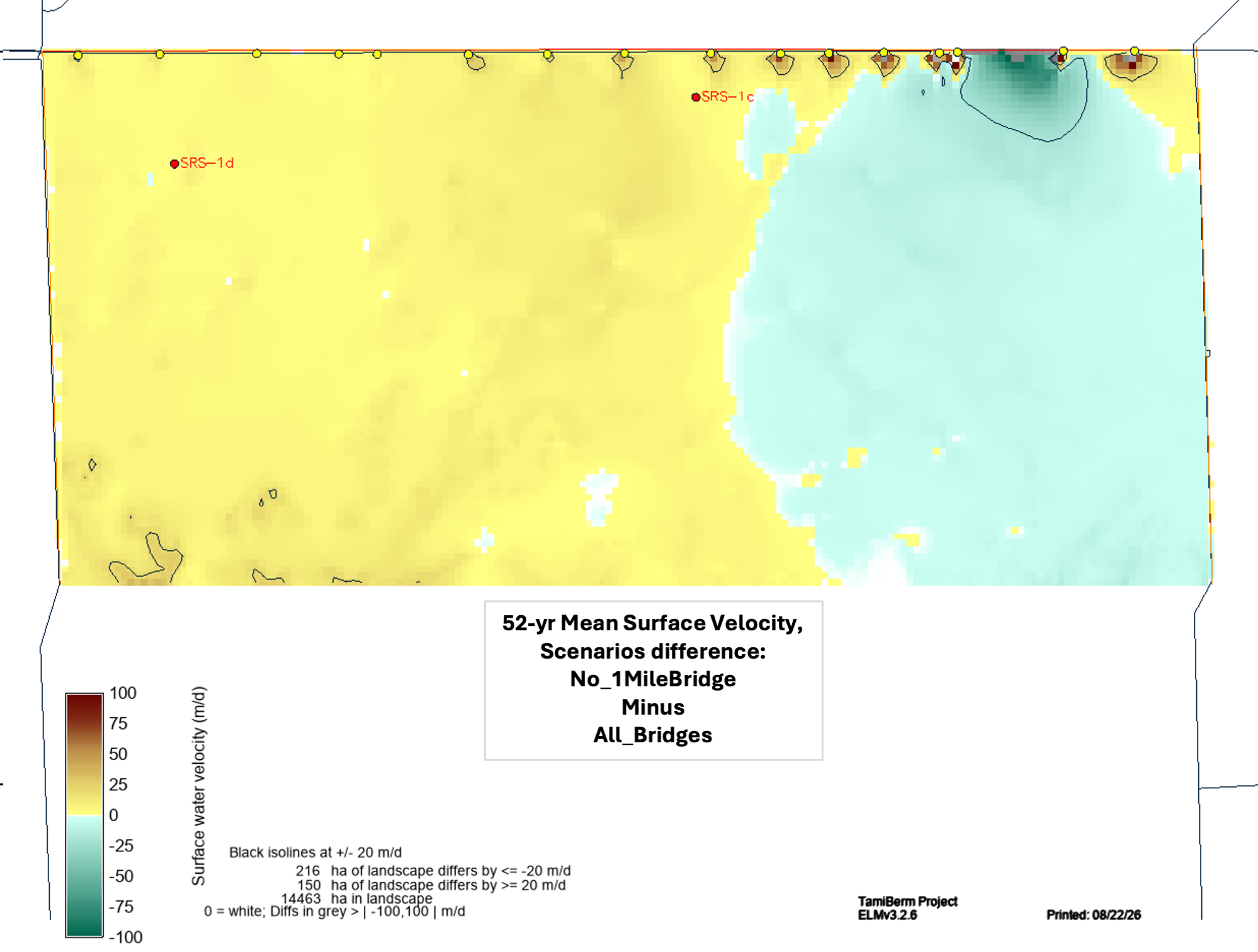 The Model Documentation (2026) report on the new fine scale NESRS model, including Tamiami Trail flow & P load scenarios, ELM v3.2.6 is found at this Publications link.
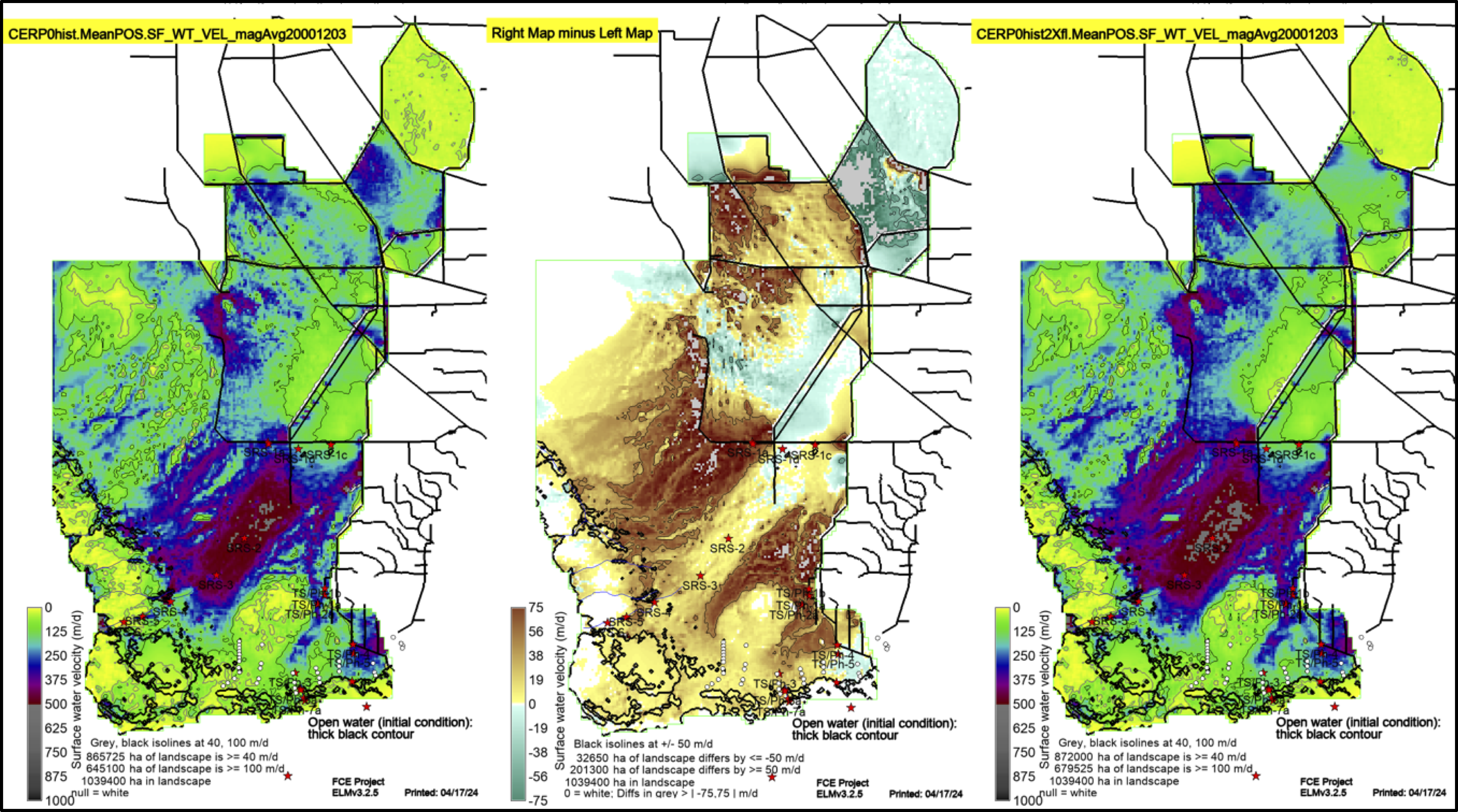 The Model Documentation (2024) report on the regional ELM applications of CERP ENP-flow scenarios, ELM v3.2.5 is found at this Publications link.
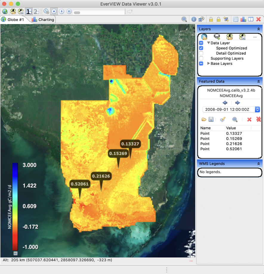 The Model Documentation (2023) report on the regional ELM phosphorus-periphyton performance update to ELM v3.2.4 historical (calibration/validation) performance assessment;
added multiple mangrove monitoring sites for performance assessments; added empirical modules for fish and for diatom communities; added code to represent current variables as Net Ecosytem Exchange
(for comparison to carbon flux monitoring towers), is found at this Publications link.
The Model Documentation (2023) report on the regional ELM phosphorus-periphyton performance update to ELM v3.2.4 historical (calibration/validation) performance assessment;
added multiple mangrove monitoring sites for performance assessments; added empirical modules for fish and for diatom communities; added code to represent current variables as Net Ecosytem Exchange
(for comparison to carbon flux monitoring towers), is found at this Publications link.
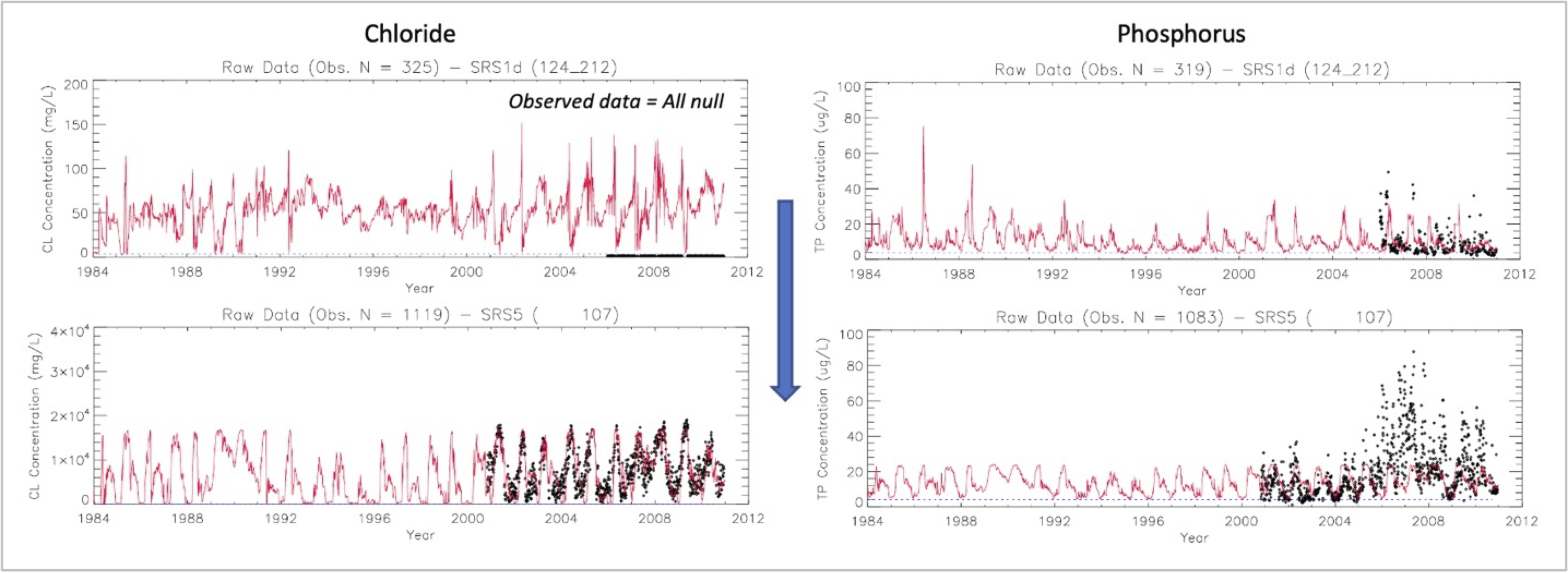 The Model Documentation (2021) report on the regional ELM major update to ELM v3.2.1 historical (calibration/validation) performance assessment - extended through 2010
- is found at this Publications link.
The Model Documentation (2021) report on the regional ELM major update to ELM v3.2.1 historical (calibration/validation) performance assessment - extended through 2010
- is found at this Publications link.
For several years through 2017, a collaboration organized by Florida Atlantic University and several government agencies involved multi-stakeholder workshops to develop plausible scenarios of future climate change and sea level rise (SLR) in south Florida.
As part of this effort, the South Florida Water Management Model (SFWMM) was run under a variety of such future scenarios (Obeysekera et al. 2014).
Daily flows through water control structures from those SFWMM runs drove the managed flows of the ELM, which explicitly integrates dynamic flux equations of hydrology, nutrients, plants, and soils (Fitz et al. 2011,
Fitz and Paudel 2012). As detailed in Obeysekera et al. (2014), the 36-year Baseline future run
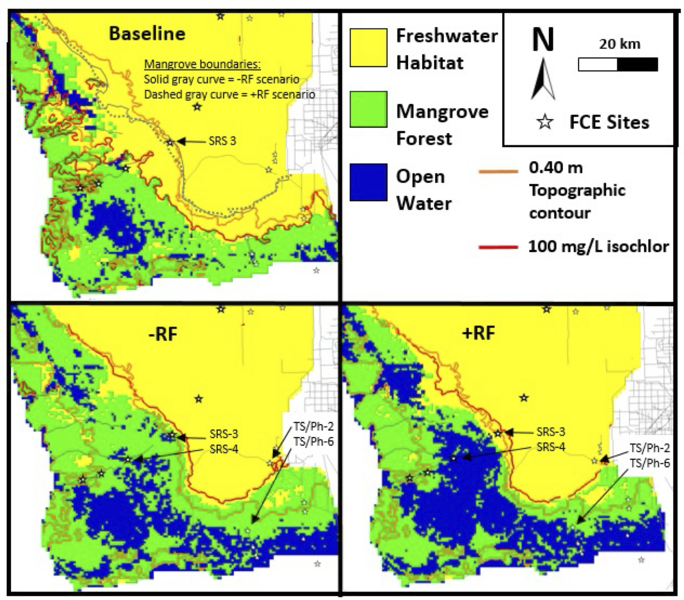
assumed 2010 initial conditions, to which two future scenarios were compared: (a) a 10% decrease in precipitation, an increase of 1.5 degrees C and associated 7% increase in potential ET, and a 50-cm rise in sea level and
(b) a 10% increase in precipitation, an increase of 1.5 degrees C and associated 7% increase in potential ET, and a 50-cm rise in sea level.
ELM-application results: In the encroaching marine-influenced subregion: water depths and salinities increased under both scenarios along a topographic-influenced gradient; phosphorus accumulation rates generally increased under both scenarios,
due to higher phosphorus concentrations in marine sources; and peat accretion rates generally decreased under both scenarios due to interactions between changing habitat types, altered nutrient availability,
increased salinity, and subsequent decreases in plant productivity. Freshwater habitat (e.g., sawgrass marsh) area decreased by more than 25% under both scenarios and was largely replaced by mangroves and,
in the increased rainfall scenario, open water as well. Adaptive planning efforts that foster upward peat accretion may help support both mangrove and freshwater marsh habitats. We infer that ecological effects related
to sea level rise may occur in extremely oligohaline water, that topography will control the incursion of this zone as sea level rises, and that differences in freshwater availability will have ecologically significant effects within the oligohaline zone.
 We published these manuscripts (Flower et al. 2017, 2019)
on the project and results.
We published these manuscripts (Flower et al. 2017, 2019)
on the project and results.
See also this April 2017 (26 Mb) PowerPoint presentation of some of the principal results from the project.
EcoLandMod Projects