![]() Background |
Models |
Projects |
Publications |
People |
News
Background |
Models |
Projects |
Publications |
People |
News
![]() Background |
Models |
Projects |
Publications |
People |
News
Background |
Models |
Projects |
Publications |
People |
News
Introduction
Conceptual model: South Florida
Wetland ecological models
Generic modeling framework
Continental USA, south Florida circled: 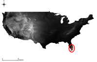
One of the first steps in developing a computer simulation model of a landscape is to conceptualize the interelationships that are thought to be important - that 'drive' the system.
 We start by looking at some of the broad changes to the regional landscape in south Florida, USA. We will then explore the interactions within, and among, the natural and 'built' systems of the Everglades and the larger region.
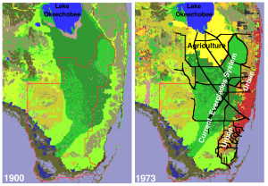
In the figure to the left, agricultural (yellow) and urban (orange/red) land use expanded dramatically in south Florida during the 20'th century. Black lines denote some of the major canals and levees that were constructed as part of the Central and South Florida Project for managing water in the region. The red polygon is the domain of the regional application of the Everglades Landscape Model.
The hyperlinked conceptual model presented below provides a "bird's eye" view of some of the interacting factors that influence - and are influenced by - these changes in the region.
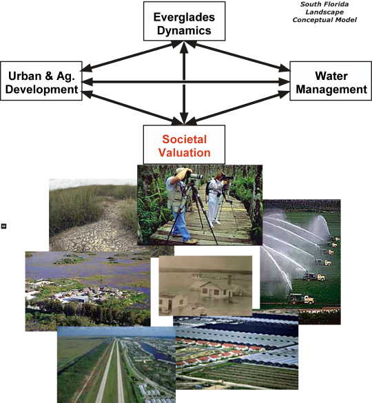
Click on this image to explore
the conceptual model interactions
among system components in
south Florida, USA.
See Chapter 1 (Introduction) of the Everglades Landscape Model v2.5 Documentation Report in the Publications link in the main menu above for further background on this region.
 EcoLandMod Background